


Select NOAA-NWS Forecast Office Text Products
(Product availability varies with seasons, forecast office, and weather.)
Hazardous Weather Outlook for Washington/Baltimore, MD
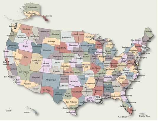
To Select Another NWS Office Click on Map or Choose from List
|
| Select Forecast Office: | Select Product: |
109 FLUS41 KLWX 132030 HWOLWX Hazardous Weather Outlook National Weather Service Baltimore MD/Washington DC 430 PM EDT Thu Mar 13 2025 ANZ530>543-DCZ001-MDZ008-011-013-014-016>018-504-506-508- VAZ053>057-527-142030- Chesapeake Bay north of Pooles Island MD- Chesapeake Bay from Pooles Island to Sandy Point MD- Chesapeake Bay from Sandy Point to North Beach MD- Chesapeake Bay from North Beach to Drum Point MD- Chesapeake Bay from Drum Point MD to Smith Point VA- Tidal Potomac from Key Bridge to Indian Head MD- Tidal Potomac from Indian Head to Cobb Island MD- Tidal Potomac from Cobb Island MD to Smith Point VA- Patapsco River including Baltimore Harbor- Chester River to Queenstown MD-Eastern Bay- Choptank River to Cambridge MD and the Little Choptank River- Patuxent River to Broomes Island MD- Tangier Sound and the inland waters surrounding Bloodsworth Island-District of Columbia-Cecil-Southern Baltimore- Prince Georges-Anne Arundel-Charles-St. Marys-Calvert- Central and Southeast Montgomery-Central and Southeast Howard- Southeast Harford-Fairfax-Arlington/Falls Church/Alexandria- Stafford-Spotsylvania-King George- Central and Southeast Prince William/Manassas/Manassas Park- 430 PM EDT Thu Mar 13 2025 This Hazardous Weather Outlook is for the Maryland portion of the Chesapeake Bay, Tidal Potomac River, and I-95 corridor through central Maryland, northern Virginia, and District of Columbia. .DAY ONE...Tonight No hazardous weather is expected at this time. .DAYS TWO THROUGH SEVEN...Friday through Wednesday Isolated severe thunderstorms capable of producing damaging wind gusts are possible Sunday. .SPOTTER INFORMATION STATEMENT... Spotter activation is not expected at this time. $$ MDZ003>006-503-505-507-VAZ025>031-036>040-050-051-501-502-505>508- 526-WVZ050>053-055-142030- Washington-Frederick MD-Carroll-Northern Baltimore- Northwest Montgomery-Northwest Howard-Northwest Harford-Augusta- Rockingham-Shenandoah-Frederick VA-Page-Warren-Clarke-Nelson- Albemarle-Greene-Madison-Rappahannock-Orange-Culpeper- Northern Fauquier-Southern Fauquier-Western Loudoun- Eastern Loudoun-Northern Virginia Blue Ridge- Central Virginia Blue Ridge-Northwest Prince William-Hampshire- Morgan-Berkeley-Jefferson-Hardy- 430 PM EDT Thu Mar 13 2025 This Hazardous Weather Outlook is for portions of eastern West Virginia, northern and central Virginia, and central and western Maryland. .DAY ONE...Tonight No hazardous weather is expected at this time. .DAYS TWO THROUGH SEVEN...Friday through Wednesday Isolated severe thunderstorms capable of producing damaging wind gusts are possible Sunday. .SPOTTER INFORMATION STATEMENT... Spotter activation is not expected at this time. $$ MDZ001-501-502-VAZ503-504-WVZ501>506-142030- Garrett-Extreme Western Allegany-Central and Eastern Allegany- Western Highland-Eastern Highland-Western Grant-Eastern Grant- Western Mineral-Eastern Mineral-Western Pendleton- Eastern Pendleton- 430 PM EDT Thu Mar 13 2025 This Hazardous Weather Outlook is for the Allegheny Front counties in western Maryland, eastern West Virginia, and Highland County Virginia. .DAY ONE...Tonight No hazardous weather is expected at this time. .DAYS TWO THROUGH SEVEN...Friday through Wednesday Isolated severe thunderstorms capable of producing damaging wind gusts are possible Sunday. .SPOTTER INFORMATION STATEMENT... Spotter activation is not expected at this time. $$ |
Previous Hazardous Weather Outlooks may be found at
NWS Washington/Baltimore, MD (LWX) Office Hazardous Weather Outlooks.
(Click 'Previous Version' there to view past versions successively.
Some may differ only in time posted.)
Products Courtesy of NOAA-NWS
NWS Information Parsing Script by Ken True at Saratoga Weather - WFO and Products Scripts by SE Lincoln Weather.
Mapping by Curly at Michiana Weather and by Tom at My Mishawaka Weather.