


| WASHINGTON DC METRO AREA FORECAST DISCUSSION UPDATED National Weather Service Baltimore MD/Washington DC 1015 AM EST Thu Feb 20 2025 .SYNOPSIS... An area of low pressure will continue to move further offshore today with backside snow showers sweeping across the region. High pressure will take over late in the week. A frontal system may approach the area by early next week. |
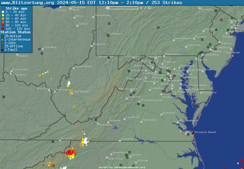
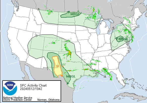
Current DC Area Radar & North America Lightning
Northeast US Radar
|
North America Lightning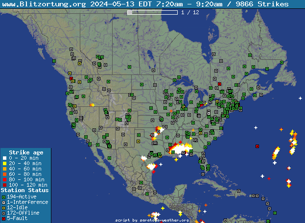
|
| Radar image courtesy of NWS. | Lightning Data courtesy of Blitzortung.org and its Contributors. |
Current Clifton Virginia Conditions & NWS Forecast
| Updated: @ 20-Feb-2025 1:50pm - next update at 2:00pm | ||||||||||||||||||||||||||||||||||||||||||||||||||||||||||||||||||||||||||||||||||||||||||||||||||||||||||||||||||||||||||||||||||||||||||||||||||||||||||||||||||||||||||||||||||||||||||||||||||||||||||||||||||||||||||||||||||||||||||||||||||||||||||||||||||||||||||||||||||||||||||||||||||||||||||||||||||||||||||||||||||||||||||||||||||||||||||||||||||||||||||||||||||||||||||||||||||||||||||||||||||||||||||||||||||||||||||||||||||||||||||||||||||||||||||||||||||||||||||||||||||||||||||||||||||||||||||||||||||||||||||||||||||||||||||||||||||||||||||||||||||||||||||||||||||||||||||||||||||||||||||||||||||||||||||||||||||||||||||||||||||||||||||||||||||||||||||
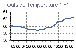
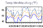
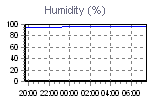
| Temperature | Summary | Outlook | ||||||||||||||||||||||||||||||||||||||||||||||||||||||||||||||||||||||||||||||||||||||||||||||||||||||||||||||||||||||||||||||||||||||||||||||||||||||||||||||||||||||||||||||||||||||||||||||||||||||||||||||||||||||||||||||||||||||||||||||||||||||||||||||||||||||||||||||||||||||||||||||||||||||||||||||||||||||||||||||||||||||||||||||||||||||||||||||||||||||||||||||||||||||||||||||||||||||||||||||||||||||||||||||||||||||||||||||||||||||||||||||||||||||||||||||||||||||||||||||||||||||||||||||||||||||||||||||||||||||||||||||||||||||||||||||||||||||||||||||||||||||||||||||||||||||||||||||||||||||||||||||||||||||||||||||||||||||||||||||||||||||||||||||||||||||||
|
|
|
||||||||||||||||||||||||||||||||||||||||||||||||||||||||||||||||||||||||||||||||||||||||||||||||||||||||||||||||||||||||||||||||||||||||||||||||||||||||||||||||||||||||||||||||||||||||||||||||||||||||||||||||||||||||||||||||||||||||||||||||||||||||||||||||||||||||||||||||||||||||||||||||||||||||||||||||||||||||||||||||||||||||||||||||||||||||||||||||||||||||||||||||||||||||||||||||||||||||||||||||||||||||||||||||||||||||||||||||||||||||||||||||||||||||||||||||||||||||||||||||||||||||||||||||||||||||||||||||||||||||||||||||||||||||||||||||||||||||||||||||||||||||||||||||||||||||||||||||||||||||||||||||||||||||||||||||||||||||||||||||||||||||||||||||||||||||


| Trends | |||||||||||||||||||||||||||||||||
| |||||||||||||||||||||||||||||||||

| NWS Weather Forecast - Outlook: This Afternoon & Tonight | ||||||
|
||||||
| NWS Weather Forecast - Five Day Outlook for This Afternoon through Monday - Last Update: Thu, 20-Feb-2025 12:30pm EST |
|
This Afternoon  Isolated Snow Showers |
Tonight Partly Cloudy |
Friday Sunny |
Friday Night  Mostly Clear |
Saturday Sunny |
Saturday Night Partly Cloudy |
Sunday Sunny |
Sunday Night Partly Cloudy |
Monday Partly Sunny |
| Hi 29 °F | Lo 20 °F | Hi 36 °F | Lo 19 °F | Hi 42 °F | Lo 26 °F | Hi 50 °F | Lo 29 °F | Hi 55 °F |
NWS Forecast Maps
NOAA Forecast Map for Today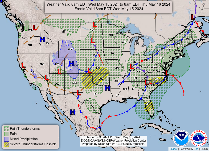
|
NOAA Forecast Map for Tomorrow
|
| Forecast map for Today courtesy of NOAA. | Forecast map for Tomorrow courtesy of NOAA. |
Random Weather Facts
|
Weather Terms Blowing Snow Advisory - Widespread blowing snow with winds 25 to 35 mph, occasionally reducing visibility to 1/4 mile or less. |
Today in Weather History
|